AIS Radar
Course-up or north-up traffic picture with configurable range, target vectors, trails and vessel-type awareness.
Collision Avoidance System
A marine collision avoidance system combining AIS radar, CPA/TCPA alarms, COLREG decision support and 3D vessel traffic awareness for safer ship navigation—on the bridge and on shore.
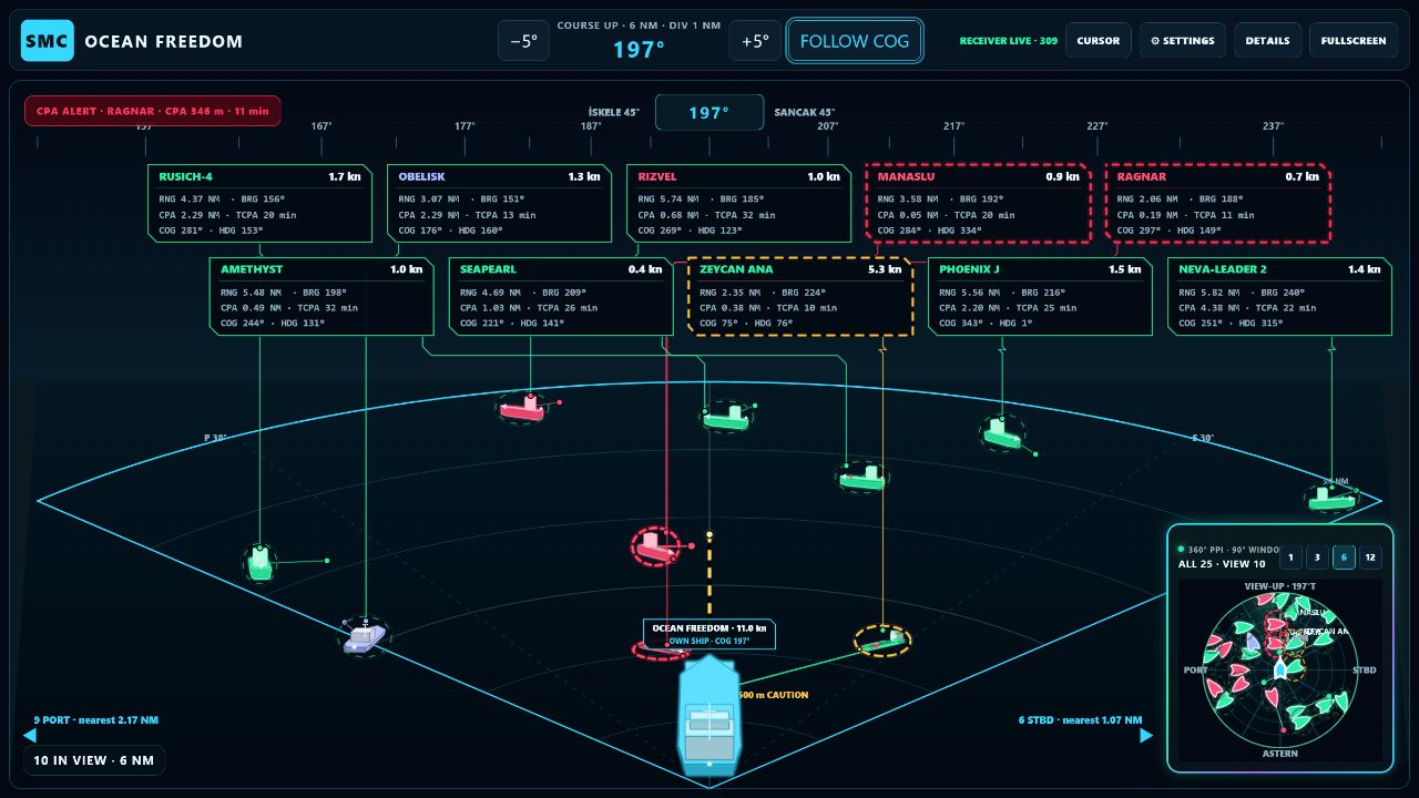
CAS combines live AIS, relative motion, vessel geometry and configurable navigation safety rules in one connected ship collision prevention platform. Officers see the encounter from the bridge; shore teams see the wider operational picture.
Targets stay connected to their data cards, course vectors and risk state. Adjustable range and view angles keep dense traffic readable.
Purpose-built modules support the full collision-awareness workflow while keeping the officer in control.
Course-up or north-up traffic picture with configurable range, target vectors, trails and vessel-type awareness.
A bridge-centred perspective that helps officers understand where a target is, how it is moving and what matters now.
Explore the traffic field from above. Inspect target geometry, predicted motion and fleet context without losing your own ship.
Adjustable risk limits, visual priority states and escalation-ready events for the bridge and shore operations team.
Encounter classification and officer guidance presented as decision support—with rule basis, confidence and limitations visible.
Review tracks, alarms and operational history. Build a traceable picture of what happened before, during and after an event.
Define port, anchorage, berth and security zones. Track entry, exit, dwell time and vessel status on a zone-first operational timeline.
Combine AIS and own-ship GNSS with optional thermal camera inputs and selected onboard or shore-side data sources.
Explore the working CAS prototype with live AIS targets, ship-centred geometry, CPA/TCPA calculations, COLREG encounter support and a navigable 3D traffic scene.
Open live Bridge View ↗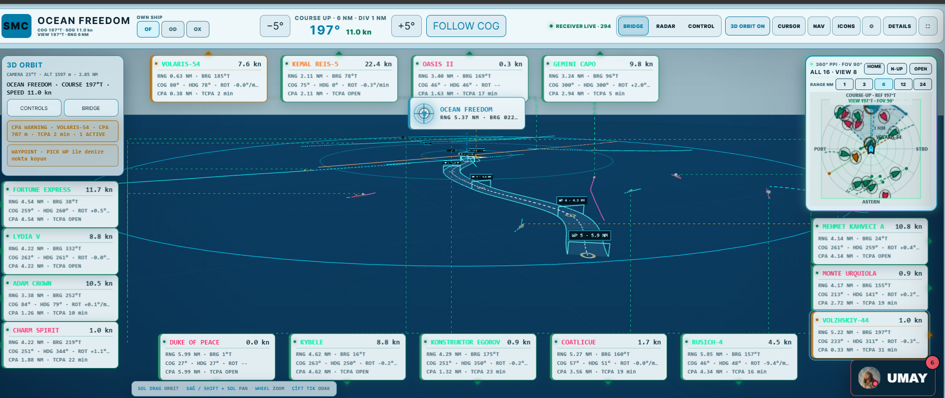 3D ORBITOwn ship · target geometry · CPA context
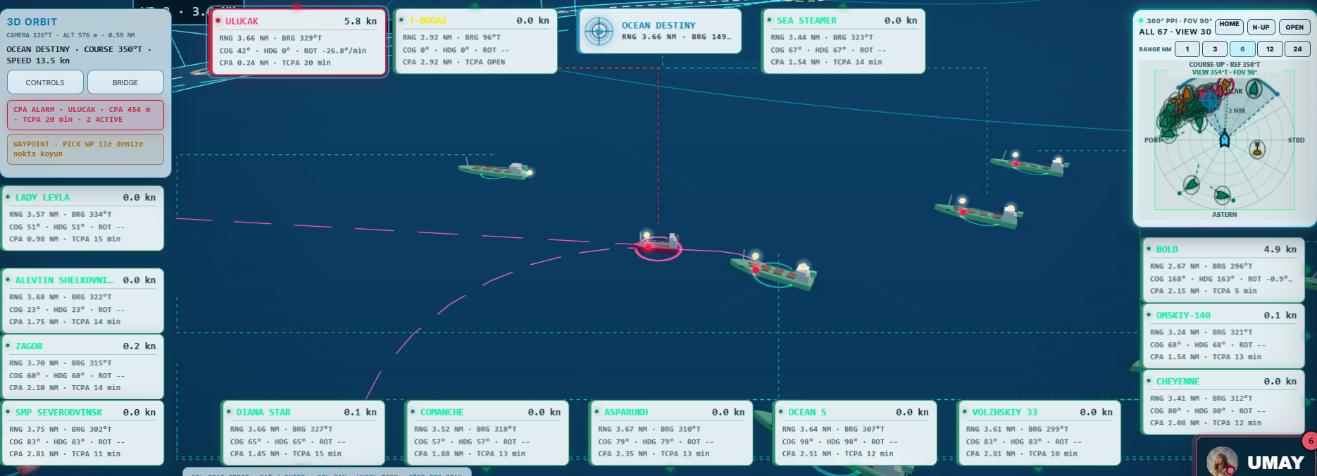 TRAFFIC FIELDHeading-aware 3D targets and track layers
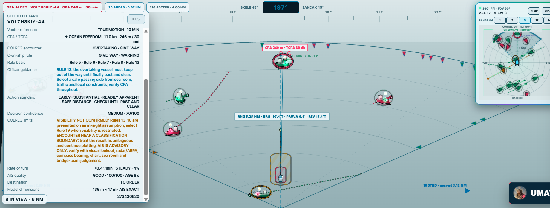 BRIDGE + COLREGSelected target, risk limits and officer support
A navigable 3D scene gives bridge and shore teams a faster sense of target location, heading, range and developing traffic density.
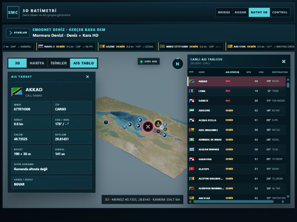 3D TRAFFIC / LIVE AIS
CAS does more than colour a target. It shows the inputs, encounter assessment, safety limits and time-to-risk behind each alert.
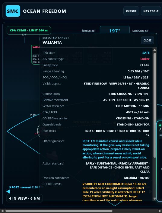
CAS is an advisory decision-support system. It is designed to support—never replace—radar/ARPA, visual lookout, COLREG compliance and the professional judgment of the officer of the watch.
CAS combines compact shipboard hardware with a shore-side monitoring environment, giving operators control of their own live picture, alarm rules and historical data.
Receives nearby AIS-equipped vessels and feeds the CAS traffic picture, target tracks and collision calculations.
Supplies accurate own-ship position, course and speed so range, bearing, CPA and TCPA calculations remain ship-centred.
Adds a visual layer for darkness, glare and reduced-visibility operations. Camera integration can support target verification and bridge awareness.
Processes AIS locally, keeps the bridge display available and stores data during connectivity interruptions.
Selected traffic, alarms and vessel status can be forwarded securely to the company's own server environment and monitored by authorised shore personnel.
Ports and shore teams can define operational and security areas, follow vessel activity live, and reconstruct each visit through a time-based history.
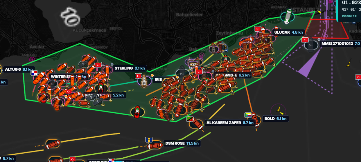
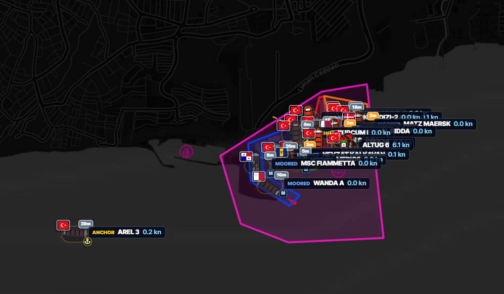
The Operations Timeline converts AIS and zone events into a chronological port-call record. Teams can move from the live map to a zone-first or vessel-first history and understand when each vessel entered, anchored, moved, berthed and departed.
Create port limits, berth areas, anchorages, restricted waters, approach corridors and custom safety perimeters.
Track entry, exit, anchor, berth, movement and dwell-time events by zone, vessel, type and selected date range.
Trigger notifications for unauthorised entry, extended dwell, boundary crossing, unexpected movement or rule-specific conditions.
Retain the underlying AIS evidence and export filtered operational histories to CSV or management-ready PDF reports.
Prioritise vessels inside monitored areas and identify stopped, moored, anchoring or moving targets without losing the wider traffic context.
Revisit vessel tracks and zone events to investigate alarms, support incident review and document operational performance.
A compact shipboard edge station can feed the bridge display and securely forward selected data to a shore portal when connectivity is available.
Local bridge awareness remains available independently; queued operational data can resume when the internet connection returns.
Ranges, CPA limits, alert routing, display density and own-ship parameters can be adapted to the vessel and operating area.
Retain AIS history, target tracks, zone activity and alarm records according to the selected storage policy and hardware capacity.
See CAS with your own traffic picture
Tell us about the vessel, operating area and existing AIS equipment. We will prepare a practical pilot configuration.